
14.12.2021.
Presentation of the Questionnaire results within Action C1
On 14th December 2021, as part of Action C1 – CROLIS data Concept and Model, experts from the Institute for Environmental and Nature Protection held a presentation on “Results of the questionnaire on the needs of users”
On 14.12.2021. as part of activity C.1 as part of Action C1 – CROLIS data Concept and Model, experts from the Institute for Environmental and Nature Protection held a presentation on the topic “Results of the questionnaire on User needs”. With the help of the aforementioned questionnaire, the aim was to collect information so that a unique information system for land could be created in a way that would provide the data and information needed by all government bodies and other users.
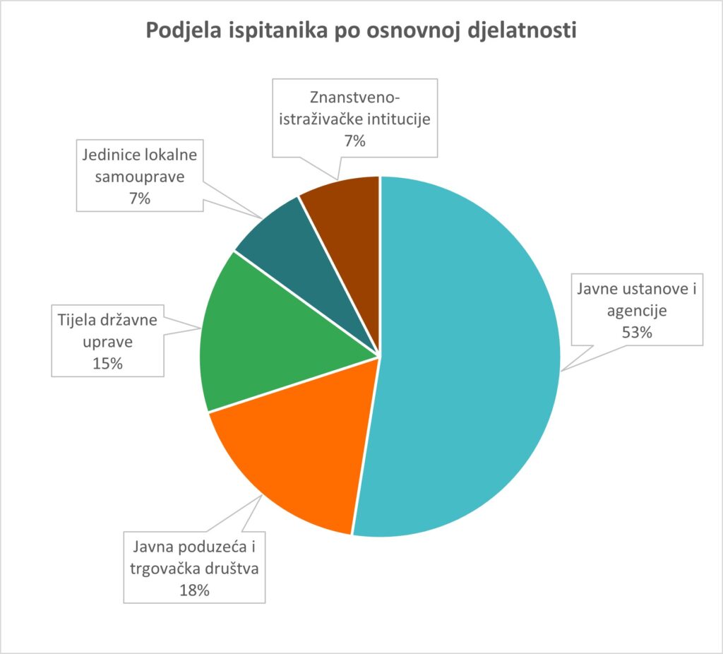
The questionnaire was sent to the addresses of 99 institutions, i.e. local and regional self-government units, scientific and research institutions, state administration bodies, public companies and commercial companies, and 81 public institutions and agencies responded. As the results showed, some public institutions and scientific and research institutions do not use spatial data, and the reasons for not using them are the lack of qualified people, the lack of technical prerequisites, insufficient education and the lack of need for their use. Those users who used them did so primarily for the purpose of spatial data display, data interpretation, spatial analysis, implementation of relevant regulations, creation of strategic plans for future development, reporting on the implementation of EU regulations, state inventory, statistical processing, service improvement and other needs. Of the users who participated in the questionnaire, 44% of them have a reporting obligation, mostly at the national and European level. Spatial data submitted for reporting purposes are related to the following classes of land cover and land use: water bodies (including wetlands), forests/forest land, grasslands, populated areas, crops/plantations, other, road land, sea, protection and preservation of cultural assets, data on the distribution of cultural assets.
In the future, users do not expect major changes in the reasons for using spatial data. As now, the most important needs will be reporting, development planning, creation and implementation of management plans, analysis and monitoring needs, management of protected areas, use of data and monitoring. An area where users expect changes concerns the additional financial resources needed to produce or secure access to future spatial data. The largest part of these funds should be directed to the education of employees, the acquisition of additional equipment, the employment of additional experts and the collection of additional data for verification. Also, almost unanimous support was recorded for the creation of a unique information system in which data on land cover and land use in the Republic of Croatia would be registered. In addition, as conclusions of the conducted questionnaire, it is worth highlighting the stated need for simpler and faster access to unified data, more precise reporting in accordance with international and EU legislative regulations, and simpler monitoring of greenhouse gas emissions and sinks from the land use, land conversion and forestry (LULUCF) sector.
Project partner Ekonerg d.o.o. participated in the preparation and implementation of the questionnaire, which consisted of 40 questions and was conducted from 1st July 1 to 15ht November 2021.
Share this news: