
Implementation of the “Pilot project to support the development of ARKOD+ (plus) and CROLIS LU initial layer” successfully completed
After ten months of implementation, the pilot project to support the development of ARKOD+ (plus) and CROLIS LU initial layer has been successfully completed. On March 15th, 2024. final delivery from work package WP7 which included corrective quarterly maintenance of spatial data and WEB GIS applications, was delivered.
The pilot project was carried out as part of Action C3 Mapping of LU and LU (wall-to-wall mapping) for the establishment of land monitoring system, and it implemented a total of seven work packages:
WP1: Analysis of necessary input data and spatial background, proposals for implementation methodology
WP2: Creation and implementation of at least two proposed algorithms for the implementation of supervised automatic classification on selected zones
WP3: Analysis and testing of the results of the performed classifications on the selected zones
WP4: Selection of algorithms and implementation of selected algorithms throughout the territory of the Republic of Croatia
WP5: Proposals for future methods and types of implementation of field visits and preparation of “ground truth” data
WP6: GIS viewer and final report and presentation
WP7: Corrective maintenance
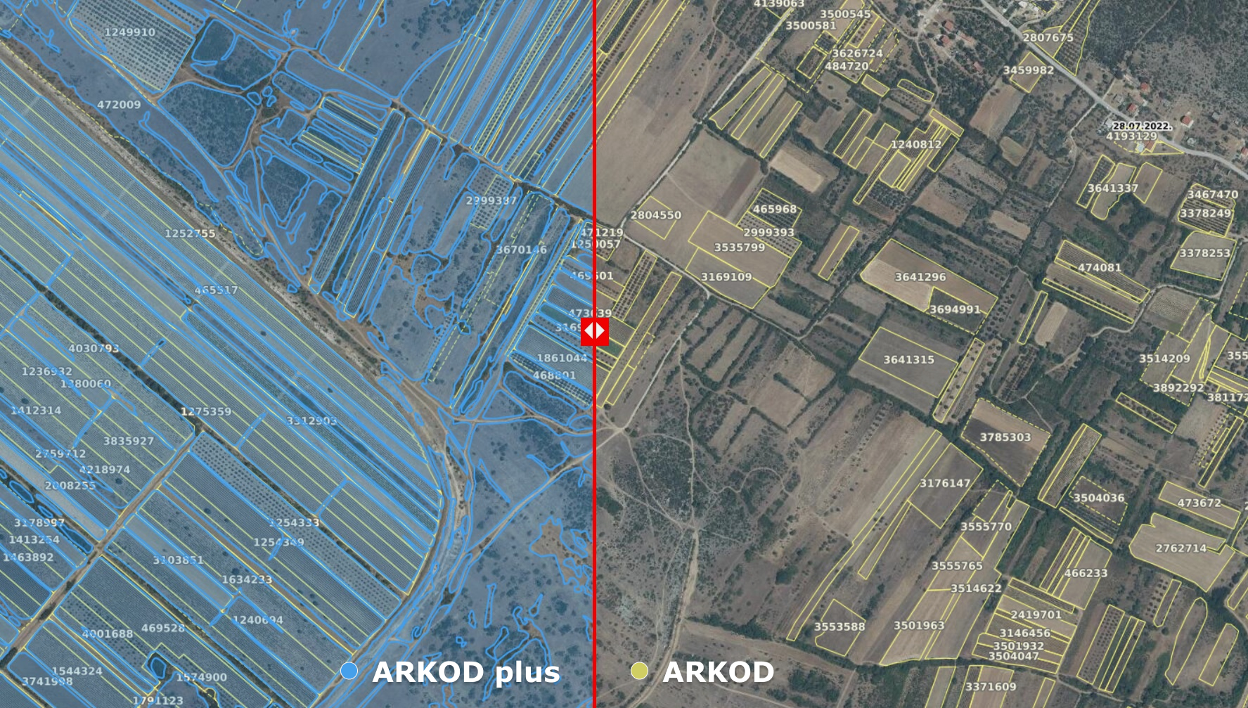
The targeted deliverables were expert reports in the field of remote sensing that will serve as important documents for further preparation of the necessary specifications for the construction of an information system. In addition to the above, the subject of delivery is spatial data that is the result of test analyzes and processing of original spatial data. The results of satellite data research (Sentinel2) are the initial ARKOD plus spatial data, i.e. agricultural area outside the ARKOD system and the created LU land layer with basic classes for the entire territory of the Republic of Croatia.
During the entire duration of the project, the employees of the Paying Agency in Agriculture, Fisheries and Rural Development actively participated in the preparation of the original training data, validation and verification of the delivered data, and established high-quality and fruitful cooperation with the selected service providers.
The conclusion obtained from the implementation of this project is that in order to produce the best possible quality results of ARKOD plus and the initial LU layer, it is necessary to prepare the highest possible quality input spatial data. For this reason, the Paying Agency in the coming period will launch training data vectorization activities, taking into account the fact that high-quality input data is a basic prerequisite for the successful establishment of a satellite data processing methodology for the purposes of recording the automatic classification of agricultural land outside the ARKOD system, as well as the way other land is used in the Republic of Croatia.
Podjeli ovu novost koristeći: